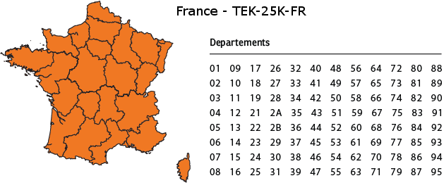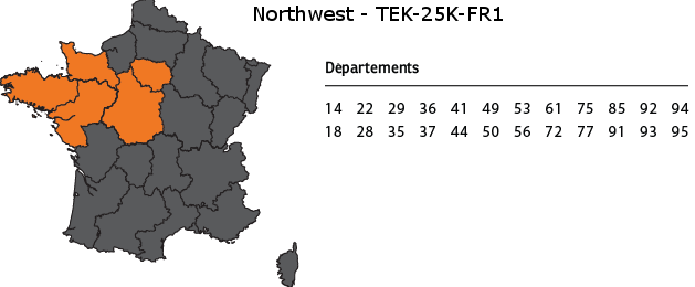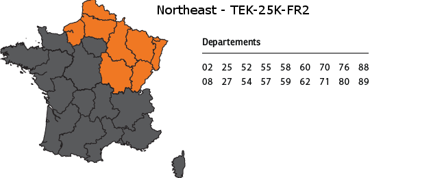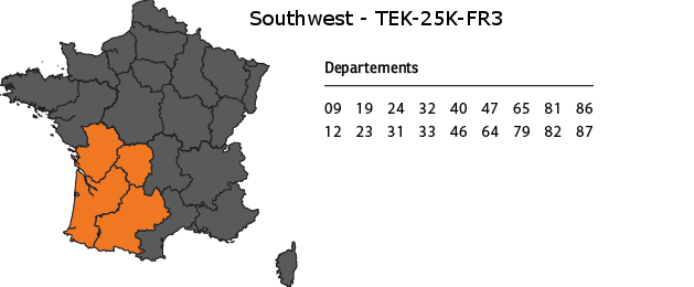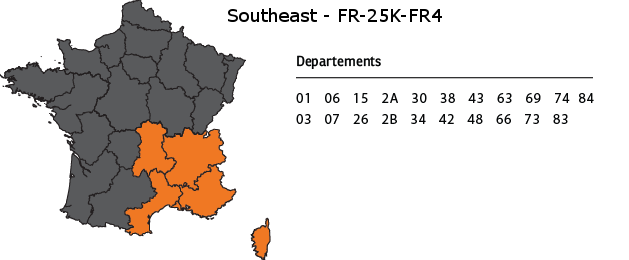


Regional maps for France
TEK Series 2.0 now offers enhanced tracking capabilities with new detailed maps. Regional maps have increased topographical detail (1:25,000 topographic map)
Equipped with SCAN 25® digital images from IGN maps. They are compatible with TEK-V2LT-E and TEK-V2L-E and are available in five regional formats.